Start the day on the padel courts at La Loma. By lunchtime you could be walking the seafront at Los Boliches, deciding where to stop for fresh fish. Explore the streets around VANGÅRD, then look inland to the trails above Mijas Pueblo.
¹ From the public road beside VANGÅRD. ² Aena’s approximate journey time from Fuengirola station. Airport train information
Interactive map
What’s nearby?
Choose a marker or a place from the list for a photo, a local tip and directions. Switch to the town or regional map to see where it sits in relation to VANGÅRD.
The developer’s rendering of the entrance to VANGÅRD.
VANGÅRD
Starting point
VANGÅRD
VANGÅRD sits on the inland side of Fuengirola, beside La Loma park. From here you can walk through Los Boliches to the seafront and follow the promenade along the beach.
The centre also has a laboratory and radiology services. Its 24-hour urgent care service covers general medicine. Contact the centre to arrange an appointment or ask whether it accepts your health insurance.
The Fuengirola centre is useful for an outpatient appointment close to home. The same group runs Vithas Xanit Internacional hospital in Benalmádena for inpatient care. You can find the list of specialists and request an appointment on the clinic’s website.
The same train stops at Los Boliches, Benalmádena and Torremolinos. Airport operator Aena gives about 34 minutes between Fuengirola station and Aeropuerto. Allow extra time to reach the station and wait for a train.
On the brochure map, number 4 points towards the airport. Switch to the regional map for the station’s actual position by Terminal 3. Aena gives roughly 34 minutes to Fuengirola terminus and eight minutes in the other direction to Málaga María Zambrano for high-speed trains. Check Renfe for current departures.
The junction linking local streets to the A-7 north of central Fuengirola.
Trains and roads
By car
A-7 coastal motorway
The A-7 runs east towards Málaga and west towards Marbella. Near Avenida Alcalde Clemente Díaz Ruiz, local roads branch off for central Fuengirola, Los Boliches and Mijas.
The local tourism guide puts the combined Los Boliches and Las Gaviotas stretch at three kilometres. Face the sea and Carvajal is to your left, with Fuengirola town centre and the marina to your right.
On Tuesday mornings, stalls sell fruit, flowers and clothes. Come back on Saturday to browse second-hand books, kitchenware and old tools at the flea market.
The markets usually run from around 9 am to 2 pm. Enter from Avenida Nuestro Padre Jesús Cautivo. The town occasionally uses the fairground for festivals, so check the market dates around local holidays.
About halfway along the seafront, sailing boats bob beside the pontoons. The fishing harbour lies to one side, with cafés and restaurants along the water.
Beaches, cafés and the marina follow Fuengirola’s roughly eight-kilometre seafront. The pin marks the peseta monument in Los Boliches, an easy place to meet before a walk.
Turn north-east for Carvajal beach, or walk south-west past the town centre towards the river and Sohail Castle. Across Fuengirola, the town lists about seven kilometres of beaches.
The castle stands on a hill above the mouth of the Fuengirola river. Walking along the promenade, you can see its outline before you reach the footbridge linking the two beaches.
Calle Camilo José Cela curves past the circular bullring. Look for the row of arches and the Plaza de Toros sign as you walk around the corner from BIOPARC.
Follow the Fuengirola river towards the sea. Beneath Sohail Castle, the Puente de la Armada Española footbridge spans the river mouth, with views of the beach and the castle hill.
The park has three padel courts, a climbing wall, a pump track, a football pitch, a children’s cycle track and picnic areas. The developer’s brochure calls stop 14 “Loma del Real Park”. For the park beside VANGÅRD, use the council’s name, Gran Parque de la Loma. The similarly named Parque de la Loma del Real is in Mijas.
Shaded paths link forest habitats. With children, take your time at the enclosures and watch for movement among the leaves and rocks. Check the park’s opening hours, tickets and activities for your visit.
Costa Mijas reopened as a full department store on 12 November 2026. Its six shopping floors cover fashion, electronics, homeware and groceries. The chain’s separate Fuengirola outlet is at 33 Avenida Nuestro Padre Jesús Cautivo, near Los Boliches.
You can do the weekly shop, stop for lunch or catch a film. For this centre, navigate to Centro Comercial Miramar on Avenida de la Encarnación in Fuengirola. Parque Comercial Miramar is a separate retail park in neighbouring Las Lagunas de Mijas.
Robert Trent Jones Sr designed both 18-hole courses. Los Lagos opens out into broad fairways around nine lakes. At Los Olivos, tree-lined fairways and smaller raised greens reward a more precise shot.
The shop is west of the residences on Carretera Mijas–Fuengirola. The walking route from the public road beside the development is about 500 metres. Allow roughly seven to ten minutes, depending on your entrance.
Of Fuengirola’s two central stations on this map, Los Boliches is closer to VANGÅRD. The walk from the public road beside the development is about 1.6 km. Take a Málaga Centro-Alameda train for the airport. In the other direction, Fuengirola is the next and final stop.
Vithas offers local outpatient appointments in Fuengirola. Its Xanit Internacional hospital in Benalmádena has inpatient wards, operating theatres and an emergency department.
La Esquina de Chinorros has a terrace on the Calle Alemania corner, with breakfast, tapas and larger sharing plates. Casa Colón is a short walk away on Calle Troncón. If you want to try several dishes, ask for a media ración, a half portion.
Keep following the shore from Los Boliches towards Carvajal for lunch by the beach. The team can help you choose from the day’s catch and suggest how much to share. Booking details are on the restaurant’s website.
Start at Plaza Virgen de la Peña. Nearby, the Mirador del Compás overlooks the hills and the coast, beside a small shrine carved into the rock. From here, explore the old town’s whitewashed lanes on foot.
If driving, head for the entrance to the Virgen de la Peña car park. The M-122 bus also runs from central Fuengirola to Mijas Pueblo. Check the timetable for your chosen day.
A pine-shaded path climbs above the white houses of Mijas to the Ermita del Calvario. From Plaza Virgen de la Peña it is about 800 metres each way, with roughly 110 metres of ascent.
From the square, follow Calle San Sebastián and Calle Calvario to the A-387. Follow the waymarks across the road and up the trail past the iron crosses. The coast opens up on the way back down. Reach the village via the Virgen de la Peña car park or the M-122 bus. The walk includes steps and uneven ground, and is about 1.6 km there and back.
At the north-eastern end of Fuengirola’s seafront, fine sand gives way to a promenade lined with beach restaurants. From Los Boliches, the walk follows the shore all the way.
Pause at Torreblanca beach along the way, or carry on to Carvajal for lunch. For the journey back, Carvajal station is uphill from the beach and serves Fuengirola on the C1.
The white church of Nuestra Señora del Rosario looks over Fuengirola’s main square. Stop for a coffee in the shade while people make their way along the narrow streets to the sea.
Ask for an espeto de sardinas to try this Málaga coast favourite. See what fresh fish is available that day, then pick up the promenade again after lunch.
Drive to Mijas Pueblo or take the M-122 bus from Fuengirola. From the village square, walk past the whitewashed houses and climb to the hillside chapel for a view back to the coast.
V marks the development. Stops 1–19 are in the original brochure. Stops 20–29 add everyday essentials, places to eat and ideas for getting out of town.
Walking and driving distances are estimates along mapped routes from the public road beside VANGÅRD. The entrance you use and current access can change the distance. OpenStreetMap and OSRM routing data
Spain’s national tourism board describes around eight kilometres of coastline in Fuengirola. The town council counts seven kilometres of beaches. Both figures cover the whole municipality. Spain’s official tourism guide · Fuengirola beach department
Los Boliches beach, looking towards Carvajal. Partonez · CC BY-SA 4.0 · Cropped, resized and compressed.
The Carvajal coastline seen from the water. Tyk · CC BY-SA 3.0 · Cropped, resized and compressed.
Fuengirola marina with the Sierra de Mijas in the distance. Olaf Tausch · CC BY 3.0 · Cropped, resized and compressed.
Sohail Castle after dark, its walls glowing above the treetops. Thomas Dahlstrøm Nielsen · CC BY 4.0 · Cropped, resized and compressed.
The monument to the peseta on the promenade, by local sculptor José Gómez Guerrero. Zarateman · CC0 1.0 · Cropped, resized and compressed.
Nuestra Señora del Rosario church seen from Plaza de la Constitución. Scorpion54 · CC0 1.0 · Cropped, resized and compressed.
The illustrated VANGÅRD map from pages 16–17 of the developer’s brochure. VANGÅRD Costa del Sol / Nuovit Homes · Cropped from the brochure, with the key shown separately.
The entrance to Fuengirola’s Recinto Ferial fairground. Olaf Tausch · CC BY 3.0 · Cropped, resized and converted to AVIF and WebP.
The Plaza de Toros on Calle Camilo José Cela. Diego Delso · CC BY-SA 4.0 · Cropped, resized and converted to AVIF and WebP.
The Osborne bull on the hill in Torreblanca. georama · CC BY 3.0 · Cropped, resized and converted to AVIF and WebP.
Puente de la Armada Española at the river mouth, between the riverside park and the beach. Diego Delso · CC BY-SA 4.0 · Cropped, resized and converted to AVIF and WebP.
ALDI on the Mijas road, showing the approach from neighbouring streets. Sistema Cartográfico Nacional de España (SCNE), PNOA · CC BY 4.0 · Obra derivada de PNOA 2025 CC BY 4.0 scne.es · Cropped from a georeferenced aerial image, resized and converted to AVIF and WebP.
The El Corte Inglés building near Calle Santa Laura in Las Lagunas, photographed from the air in 2025. Sistema Cartográfico Nacional de España (SCNE), PNOA · CC BY 4.0 · Obra derivada de PNOA 2025 CC BY 4.0 scne.es · Cropped from a georeferenced aerial image, resized and converted to AVIF and WebP.
Miramar shopping centre in Fuengirola. Tyk · CC BY-SA 3.0 · Cropped to a 3:2 aspect ratio, resized and converted to AVIF and WebP.
Paseo Jesús Santos Rein near the Quirónsalud medical centre. Sistema Cartográfico Nacional de España (SCNE), PNOA · CC BY 4.0 · Obra derivada de PNOA 2025 CC BY 4.0 scne.es · Cropped from a georeferenced aerial image, resized and converted to AVIF and WebP.
The streets around the Vithas outpatient clinic on Avenida de Ramón y Cajal. Sistema Cartográfico Nacional de España (SCNE), PNOA · CC BY 4.0 · Obra derivada de PNOA 2025 CC BY 4.0 scne.es · Cropped from a georeferenced aerial image, resized and converted to AVIF and WebP.
Hospital Vithas Xanit Internacional in Benalmádena, April 2025. Zarateman · CC0 · Cropped to a 3:2 aspect ratio, resized and converted to AVIF and WebP.
The entrance to Fuengirola station on Paseo Jesús Santos Rein. Tyk · Public domain · Cropped to a 3:2 aspect ratio, resized and converted to AVIF and WebP.
A morning Cercanías train at Los Boliches station. Leo Hidalgo · CC BY 2.0 · Cropped to a 3:2 aspect ratio, resized and converted to AVIF and WebP.
Terminal 3 at Málaga–Costa del Sol Airport. Pop9000 · CC BY-SA 4.0 · Cropped to a 3:2 aspect ratio, resized and converted to AVIF and WebP.
The Los Olivos course at Mijas Golf. Roger Husvik · CC BY 3.0 · Cropped, resized and converted to AVIF and WebP.
A fairway at Chaparral Golf Club in Mijas Costa. Chaparral Golf Club · CC BY-SA 4.0 · Cropped, resized and converted to AVIF and WebP.
Mijas Pueblo beneath the slopes of the Sierra de Mijas. Carisha · CC BY-SA 3.0 · Cropped, resized and converted to AVIF and WebP.
The whitewashed Ermita del Calvario among the pines above Mijas Pueblo. TURISMO MIJAS · CC0 1.0 · Cropped, resized and converted to AVIF and WebP.
Looking across the countryside from Mijas Pueblo to the sea. Profedelengua · CC BY-SA 4.0 · Cropped, resized and converted to AVIF and WebP.
Sardines grilled on skewers at Chiringuito Videra, photographed in February 2024. Félix Ares and Álvaro Ares · CC BY 4.0 · Cropped, resized and compressed for the web.
One of the primates at Bioparc Fuengirola. Elizaveta Korabelnikova · CC0 1.0 · Cropped, resized and compressed for the web.
The junction linking local streets to the A-7 north of central Fuengirola. Sistema Cartográfico Nacional de España (SCNE), PNOA · CC BY 4.0 · Obra derivada de PNOA 2025 CC BY 4.0 scne.es · Cropped from a georeferenced aerial image, resized and converted to AVIF and WebP.
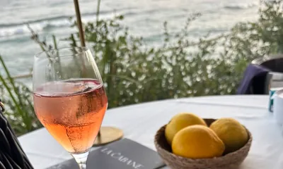
Lunch by the sea on the Costa del Sol. Illustrative coastal photograph. Photograph supplied for this guide · Cropped for different screen sizes.
Walk the neighbourhood with us
Tell us which places would be part of your day. On your VANGÅRD viewing, we can walk the route to the park, the station or the sea with you.